Wednesday, 12 October 2011

Journey's End - Port Everglades, Florida


These photos were taken on arrival at the Port Everglades Cruise Terminal (Fort Lauderdale) on Tuesday morning, before our afternoon visit to Miami’s Dolphin Mall, and the overnight flight back to the UK.

Sunday, 9 October 2011

Oranjestad, Aruba


Our final port of call yesterday was Oranjestad, capital of the island of Aruba.  Aruba lies only 17 miles north of the Venezuelan coast, and together with its neighbours Curaçao and Bonaire, make up a group of islands known collectively as the Leeward Antilles.

Aruba is one of four countries that make up the Kingdom of the Netherlands, the other three being the Netherlands itself, the aforementioned Curaçao, and Sint Maarten - a small island country further north in the Lesser Antilles. Aruba's Dutch heritage is evident on arrival in Oranjestad, as several of the buildings in the city centre feature ornate Dutch colonial style architecture.  Dutch is also widely spoken, along with English and the local language, Papiamento.

Despite the Dutch influences, Oranjestad still has a distinctly Caribbean atmosphere, and this is particularly evident from the main street with its many themed cafes, bars and shops. Before the ship berthed, we also noticed the coastline around the capital was lined with beach resorts, hotels and villas, all taking advantage of the silver sandy beaches that surround many parts of the island.

We decided to go ashore independently as the ship berths at a dedicated cruise line terminal which is only metres from the city centre.  As we were only there for six hours, we felt the time would be best spent exploring the city centre and seafront at our own leisurely pace. The temperature was also nudging 31 degrees, so we didn't feel like wandering too far. After doing some sightseeing and taking a few photographs we parked at an outdoor cafe for a few cocktails in the afternoon sun, before returning to the ship in the late afternoon.  Darkness fell quickly that evening, and by 1900hrs, we had set sail on the final leg of the voyage towards Fort Lauderdale in Florida.

We are currently in the middle of the Caribbean Sea heading north. Our route will take us between the islands of Cuba and Hispaniola (Haiti and the Dominican Republic) before skirting the west of the Bahamas.  Whilst still warm, the weather has turned unpleasant with heavy rain, occasional thunderstorms and moderate seas. There is one final day at sea tomorrow before we leave the ship on Tuesday morning.  We have taken advantage of a simple and reasonably priced shore excursion on arrival in Fort Lauderdale, where we will be taken to one of Miami's largest malls for a few hours, before being transported to the airport for the overnight flight home.  Whilst it's not the most exciting of venues, it beats spending over nine hours in Miami airport.

This is also our final blog post for the holiday, as the journey is almost over, and our internet access package (100 mins for $55) is about to expire!   We may post an addendum later in the week with some photographs of Fort Lauderdale and Miami.  But in the meantime, thanks for following and we hope you have enjoyed reading our travelblog.

Bye for now, Andrew & Christine  J

Saturday, 8 October 2011

Cartagena


Our first experience of the South American continent came about yesterday with our arrival into Cartagena de Indias, the fifth largest city in the Republic of Colombia. Although Colombia was already populated by indigenous peoples, the 'discovery' of this new land by the Spanish led to the construction of Cartagena. The city was founded in 1533 by the explorer, Don Pedro de Heredia, and was used as a shipping gateway for exporting emeralds and gold back to Spain.

Despite evolving into a modern city with contemporary sky scrapers, condominiums and a thriving oil industry, Cartagena has fortunately managed to preserve its colonial old town, complete with city walls and fortress. Due to the historical significance of the buildings, architecture and monuments, the area has been designated as a UNESCO world heritage site.

The ship berthed in at the commercial docks around 0700hrs and a fleet of coaches was waiting to whisk us and other passengers off on the various shore excursions.  We opted for a horse and carriage tour of the old town as we felt this would be the best way to see the buildings and streets, in the strong morning sunshine.

A coach transfer was used to get us from the docks to the old town, and on the way, we spent a few minutes at the San Felipe fortress, built to defend the city from attack during the 17th century. Although the city had fallen to several siege attacks during this era, a strengthening of the defences meant that the last major invasion in 1741 led by British and American colonial forces, was unsuccessful.  With fewer than 6000 men, the city successfully defended itself from an invading force of over 23000.

We arrived in the old town area and transferred onto the horse-drawn carriage for a 50 minute tour of the old city streets. It was hot, very hot, in the town, and we passed several other tour groups on guided walking tours, who looked like they were starting to suffer from the intense, stifling heat.  The carriage proceeded at a leisurely pace through the streets, and with its open top, allowed us to easily photograph the area as we passed. Many of the buildings were painted in vibrant colours, and we learned that those with wooden balconies were predominantly from the colonial era, whereas those with stone or concrete balconies dated from the republican era - after Colombian independence from Spain was recognised in 1819.

At the end, we had about 30 minutes to explore on our own. There are a lot of street vendors in this area, who try to sell fake goods (cigars, perfumes etc) and other tat. They are neither aggressive nor persistent, although the sheer number of them does get a little annoying after a while.  Thirty minutes was quite sufficient, and  after purchasing some local souvenirs, we headed back to the coach for the transfer to the ship.

We left Cartagena shortly before 1400hrs yesterday and set an easterly course for the overnight journey to Aruba. We are due to arrive in the island's capital, Oranjestad, at about 1300hrs today.

Friday, 7 October 2011

Panama Canal


It's Day 13 today, which meant it was time to cross the Americas, courtesy of the Panama Canal.  The day started off early - very early in fact, as the engines were started about 0400hrs local time.  The local pilots were boarded and we shifted from our anchorage and started to move towards the approach channel.

By 5am, it was still dark although the first glimmers of dawn could be seen in the distant skyline as some overnight thunderstorms gradually fizzled out. As the daylight came, we moved cautiously up the channel closer towards the first set of locks at Miraflores. On the way, we passed under the Bridge of Americas - a 1960s construction which once carried the Pan American highway, but now relegated to local trunk road status.

We reached the Miraflores locks shortly after 6am. This was a set of two locks which lifts ships up approximately 15 metres. As we enter the locks, electric railway engines on the quayside known locally as 'mules' guide the ship into the lock using tensioned tow lines which are attached to both the bow and stern. Once in position, the lock gates behind the ship are closed and water is allowed to enter the lock from further upstream, thus raising the level of the ship. Once the water levels have equalised, the lock gates in front are opened, the mules guides the ship into the next lock, and the process is repeated once again.

After the Miraflores locks, the ship sails in a widened canal section for another half mile or so, before entering the Pedro Miguel lock.  This is just a single canal lock, but it raises the ship another few metres,  sufficient to allow it to cross the relatively low-lying terrain of the isthmus.  We note that all of the canal traffic at this point is in one direction only, and we don't pass a single ship travelling in the opposite direction.  The reason soon becomes clear as our guide for the day, explains on the ship's PA. The canal authority regulates the flow of ships each way so that ships travelling in opposite directions are timed to pass only in the larger central section of the canal, known as Gatun Lake.  This clever piece of scheduling is designed to reduce the wash erosion on banks of the narrower sections of the canal.

After Pedro Miguel, it's into the Culebra Cut, one of the most challenging sections to construct. This narrow section of the canal was carved through rock and limestone, and extends for over 12 kilometres. Steep banks surround each side of the canal, and we pass under another bridge - the Centennial Bridge. This relatively recent structure was built in 2003 to commemorate the 100th anniversary of the Republic of Panama gaining its independence from Colombia.

Eventually, the cutting opens out into Gatun Lake and the appearance of the canal changes considerably.  Rather than navigating a narrow man-made channel, we are now cruising through more natural looking waters surrounded by indigenous jungle on either side.  In reality though, the lake is itself partially artificial, having been significantly enlarged as part of the canal construction programme during the last century to provide enough depth and clearance to passing ships.

It's also worth mentioning the massive construction works which are currently on-going adjacent to the current canal route. This is part of a huge expansion project to provide increased capacity, due to open in 2014. New, larger locks are being built at either ends with existing navigation channels being deepened and widened.

After navigating Gatun Lake, we reach the Gatun Locks - a set of three concurrent locks which lowers us a full 26 metres back down to sea level. Once the 'descent' has been completed, it's an impressive sight looking backwards watching the line up of large cargo vessels taking their place in the queue.

So now we're in the Caribbean Sea and heading east towards Cartagena, Colombia, where we are due to dock around 0800hrs tomorrow morning. A morning tour of the old town has been pre-booked, and we'll post a full report tomorrow.

Thursday, 6 October 2011

Panama City


Our afternoon city tour of Panama City took about four hours.  The ship's tenders take passengers to Fuerte Amador  - a small man-made harbour hosting a yacht marina and a pier for visiting cruise ship passengers, complete with police and customs facilities.  The complex is set on a small island, which is now connected to the mainland via a long causeway, some of which is lined with shops and restaurants.

The objectives of the city tour were to explore the colonial city, the new city, and the ruins of the original old town (Panama Viejo) in which some of the first Spanish conquistadors settled during the 16th century.

The journey along the causeway to the city took about 15 minutes, and on the way our tour guide pointed out some of the party retreats of the former dictator president, Manuel Noriega. We also passed through some very questionable looking suburbs, which our guide warned against wandering alone, especially  if one wasn't of Hispanic ethnicity...  

The first stop on the tour was the colonial city, or old quarter, which featured many buildings of architectural styles dating from the Spanish colonial era.  Sadly, a lot of the buildings were in a state of disrepair, although much regeneration is now taking place to breathe new life into the area.  Some of the ruined buildings are stark reminders of the US invasion of Panama in 1988, in which many Panamanian civilians lost their lives. Nowadays, the old quarter is one of the most frequented areas of Panama City by tourists, second only to the nearby Canal itself.

Next on the itinerary was a drive along the main arteries of the new city. This part of the city is home to an impressive array of modern sky scrapers, which wouldn't look out of place in the downtown areas of most American, European or Far Eastern capitals. Consisting of a dense mixture of office blocks, condominiums and hotels, it's fairly obvious that there is no shortage of cash in this very affluent part of the city.

By now, it was late afternoon and traffic jams were starting to develop. In the congested city streets, tempers began to fray and it soon became apparent that Panamanian drivers were not renowned for their patience or careful driving - we witnessed at least two fairly serious accidents during this short time.

We eventually reached the few remaining ruins of the old town, Panama Viejo, which was formed by the first Spanish explorers who landed there in 1519.  The old town is located a few miles east from the current downtown area, but little remains of the original settlement as most was destroyed in a siege during 1671.  The history is best learned from visiting the nearby museum, which we quickly hurried round as time was starting to run out.

We arrived back at the ship about 1700hrs local time, and shortly after, the anchor was lifted and we manoeuvred further out into the Gulf of Panama, to the anchorage points for vessels transiting the canal. Here we will remain until early tomorrow morning - pilots will board Coral Princess at 0400hrs to guide us into the first set of canal locks at Miraflores, which we expect to reach about 0600hrs.

The canal transit tomorrow will see us transition from the Pacific west coast of the American continent, to the eastern side in the Carribean, and ultimately mark the start of the final leg of the voyage north to Florida via Colombia and Aruba.

Wednesday, 5 October 2011

Panama City


We have arrived at Fuerte Amador (for Panama City) and the ship has dropped anchor. Today, we are booked on a half-day excursion, leaving the ship at lunchtime to explore the old town, and will post a full report later. In the meantime, here are a few photographs of dawn breaking over the Panama City skyline, and our sister ship, Island Princess, about to enter the Canal.

Tuesday, 4 October 2011

Puntarenas, Costa Rica


Yesterday we stepped ashore for our pre-booked excursion to the Costa Rican cloud forest at Monteverde in the country's central highlands. This was our first ever visit to a Central American nation and upon arrival, it was immediately apparent that we were in a very different part of the world.

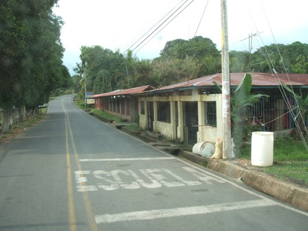
After a smooth and orderly debarkation, we boarded the minibus which was waiting for us on the dockside. The ship berths at a purpose-built cruise liner jetty extending from the beach in the town of Puntarenas. The town is also capital of the Puntarenas state, which geographically spans the entire Pacific coastline from the Nicaraguan border in the north, to Panama in the south. It's a medium sized town, built on a natural peninsula near the top of the Gulfo de Nicoya.   Initial impressions were of a shabby but functional town, set in an area of contrasts: beautiful scenery, beaches, mountain backdrops and tropical plantlife, but tapered with run-down buildings, unkempt streets and other scenes of general dereliction and occasional poverty. Contrary to what we had read on some of the cruise forums, there was nothing seedy about the town however - just an ordinary town with ordinary people going about their business.

Costa Rica is a developing country with a population of about four million citizens, and one of the most prosperous in Central America. Relying heavily on tourism, its biggest exports are coffee, bananas and according to our tour guide, microchips from computer giant Intel, who have setup production in the country in search of lower operating costs. Like many other countries, Costa Rica's government faces difficult choices on how to further develop the country, its infrastructure and its economy without compromising the natural environment and ecosystem.

After passing through the town, our minibus joined the main highway into the country's interior, before branching off the main road to climb into the mountains. The road deteriorates quickly and the last 25km are completely unpaved.  Because of the road conditions, the journey took nearly two and half hours and we were glad to alight on arrival at Monteverde.

The tour of the cloud forest is conducted from the safety of a miniature train styled on a vintage American railroad engine. The carriages are open-sided which allows ample opportunities to enjoy the vistas and take photographs. The train crawls along a heavily engineered track, sometimes only at walking pace, and descends deep into the cloud forest through a tunnel and then over a series of bridges and steep embankments. Although the area doesn't immediately present itself as a dangerous environment, the biggest risk of wandering alone is probably the danger of getting lost in the sheer vastness of the forest. Despite being a biological reserve, this is no country park and there are no trails or pathways to guide the casual and unwitting tourist. There are many steep drops and ravines, not to mention the occasional viper, tarantula, and pumas which roam after darkness falls.

The train eventually arrives at a viewpoint deep within the cloud forest, from which on a clear day, it is possible to see the Arenal crater - one of Costa Rica's most active volcanoes.  (The country is perched on the continental divide, and so there is much tectonic activity beneath the surface.) Today however, the cloud has bubbled up from the valleys below and there is nothing to see except endless swathes of white mist. 

We do fortunately get the opportunity to embark on a very short half-mile walk in the forest, accompanied by a local guide who is very knowledgeable about the country's flora et fauna.  It's hardly an exciting expedition though and the chances of seeing any bird or animal life are dashed completely as we are accompanied by our fellow tour passengers - about 20 raucous Americans, seemingly incapable of treading quietly through a forest.

It was soon time to return back on the train, and after a short lunch break and the chance to buy local crafts and souvenirs, we boarded the minibus for the long drive back down to the coast.  We were perhaps slightly disappointed by the short amount of time spent in the actual forest itself and the very tightly, micro-managed itinerary of the tour. But on reflection, our expectations were probably a little unrealistic. After all, this wasn't a trekking expedition - it was a time-constrained day excursion for cruise ship passengers of all ages. Local tour operator, Swiss Travel and their very knowledgeable guide, Irene, did a splendid job of giving us a brief and informative insight into the country, its friendly people and natural environment.

On returning to the ship, thunder storms had encroached on Puntarenas and the surrounding area. The town was on the cusp of getting drenched, and fork lightning could be seen over the hills as the skies became blacker.  We decided not to embark immediately though as our attention was captivated by flocks of pelicans who were diving into the choppy waters off the jetty in search of food.  After a few photographs and some video footage, the rain was starting to fall, so it was time to go back onboard.

We set sail at 1900hrs, with the local pilots escorting us for a short distance, before heading south alone towards Panama. 

Today, we passed abeam the Panamanian border at about 0900hrs local time.  We are travelling at a leisurely 14 knots and are expected to drop anchor at Fuerte Amador (for Panama City) tomorrow morning at 0800hrs.

Sunday, 2 October 2011

At Sea

Because of the missed call in Cabo San Lucas, we have been at sea for six days now, so there has been little to report apart from a steady passing stream of turtles and dolphins in the clear waters of the Pacific. Although the seas have been calm, the weather is somewhat volatile and we passed through a massive electrical storm a few nights ago. Yesterday also saw us adjusting course by a few degrees to avoid a tornado which had formed under a thunder cell.  The resulting water spout where it made contact with the ocean could be clearly seen from the port side. Temperatures remain around 29 degrees so we continue to make good use of the balcony.

We are now sailing along the Guatemalan coastline (about 16 degrees, 30 minutes north), and heading for the border with El Salvador.  The ship is expected to dock in Puntarenas, Costa Rica about 0700hrs tomorrow morning and many of the passengers, ourselves included, will step ashore and join one of the pre-booked excursions.

Our excursion will take us into the Monteverde cloud forest (essentially a rain forest but set at an elevated altitude of around 5000 feet). The forest has been declared a biological reserve and is home to over 3000 species of animals and plants.  We have been advised to take warm clothes and a poncho. Oh, and plenty of insect repellent...

We'll post a full report tomorrow evening, hopefully with some photographs of the day's visit.

Thursday, 29 September 2011

Cabo San Lucas


We have missed our call into Cabo San Lucas today due to weather.  Although the sea conditions are currently slight, a category 'A' hurricane (Hillary) a few hundred miles off the Baja coast threatens to produce bad weather for the coastal areas. As there is no cruise ship terminal or pier in Cabo, passengers would have been transferred to and from the shore using the ship's tenders. In an unpredictable swell, this is a risky operation as the tender is lowered into the water and then manoeuvred alongside the ship for passengers to step aboard. The tender then transfers passengers in small groups to a suitable berthing point ashore. For the whole operation to be achieved safely, it really does require calm sea conditions.  So with much disappointment, which I'm sure is shared amongst most of our fellow passengers, we have to accept that the Captain's decision is final and the ship will continue to Puntarenas, Costa Rica.

The passage plan however, remains effectively unchanged and in the distance, we can see the tip of the Baja California peninsula and the many resort hotels on the Cabo shoreline. The ship will now continue across the mouth of the Gulf of California to run parallel with the Mexican coastline, and we expect to pass abeam the popular holiday resort of Puerto Vallarta about 0900hrs tomorrow.

Tuesday night was our first formal night on board, and observance of the formal dress code was required in each of the main dining rooms. For ladies, this required an evening gown or cocktail dress, whilst the men were instructed to wear a Tuxedo, suit, or slacks with dinner jacket. Having avoided formal nights on our last cruise, we were both slightly apprehensive about the etiquette but we need not have worried.  The dining experience and format was identical to previous nights, with the only exception being the dress code itself resulting in an overall more elegant and stylish atmosphere in the dining room.  For those who do not wish to participate in the formal nights, the Horizon Court buffet or any of the speciality restaurants are always available.

The temperatures are now in the high '20s', even out at sea, and the strength of the sun should not be underestimated, as we are now only 24 degrees north of the Equator.  On Deck 15 and 16, we have been taking advantage of the ample deck space, sun loungers and bar service although this might be curtailed somewhat today after getting some painful sunburn to the legs! We prefer to keep away from the pool area on Deck 14 as the giant 'Movies Under The Stars' screen blasts out loud music during the mid-afternoon sun, making conversation slightly difficult.

Well, it's now mid-morning and time to burn off some of those calories. Three laps of the promenade deck equate to one mile, and this is by far our preferred exercise routine. Any notion of visiting that gym just sounds too much like hard work!